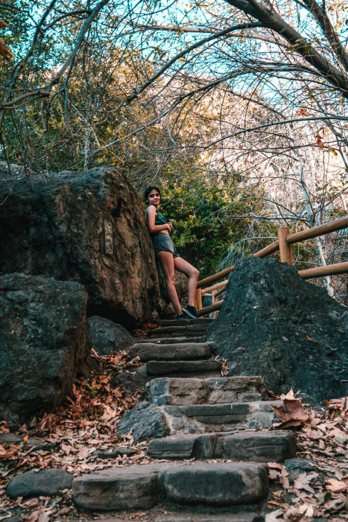
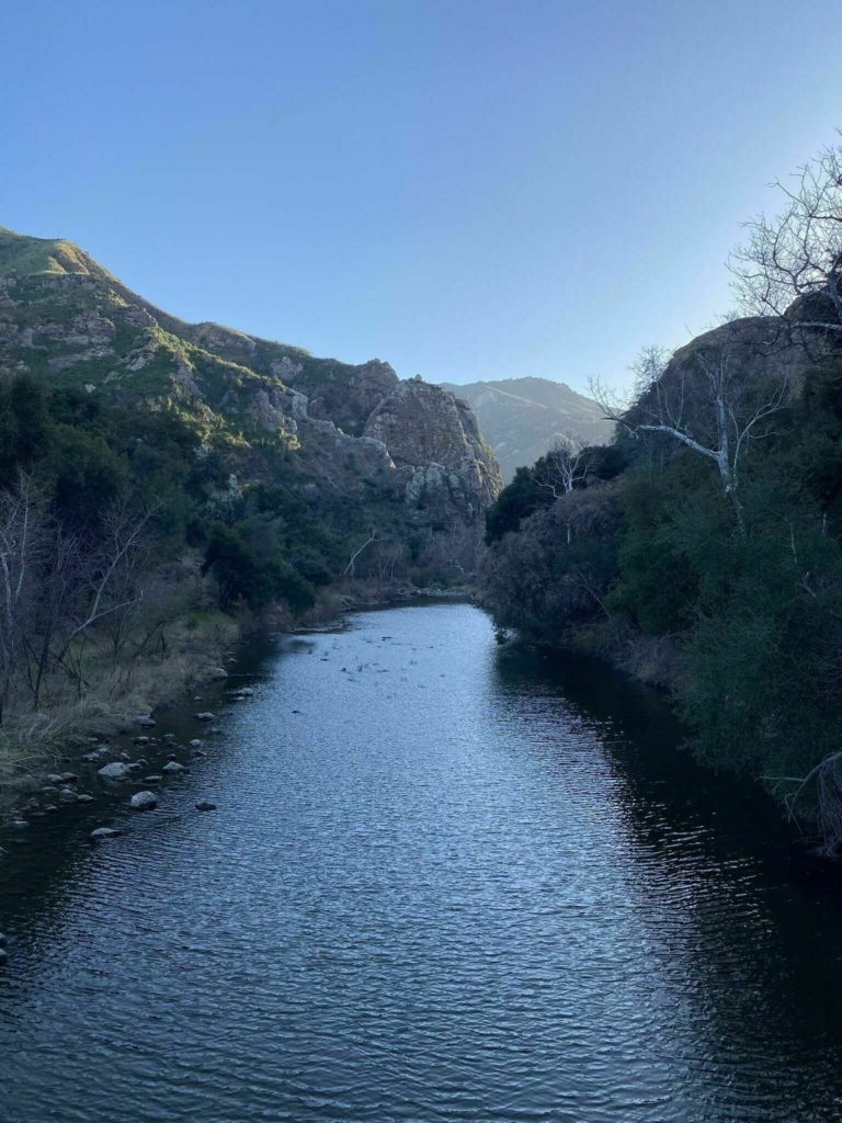
Malibu hikes are some of the best hiking trails near LA. The Santa Monica Mountains surrounding the city are gorgeous and you can see a beautiful view of the coastline from most of the hikes. The foliage on Malibu hikes is also really pretty with flowers during wet springs and lots of abandoned houses, cars and other places to explore.
There are lots of trails in the Santa Monica Mountains suited to every level of hiker. Dogs are allowed on almost all trails when they are on leash. Not only this but there are waterfalls, lakes, and really cute picnic spots on many of these trails. You are going to love Malibu hiking trails!
Tips For Hiking in Malibu
Sun protection
The temperature in southern California is generally hot with the sun shining down all day long. Most hiking trails in Malibu are in the Santa Monica Mountains where sun protection becomes a necessity. You want to carry sunscreen, hats, sunglasses and lots of water when doing these hikes.
Book ahead
Trailhead parking fills up very quickly at the popular trails. There is no entrance fee to access the trails but trailhead parking might be charged. If you go at popular times you will have to wait for someone to leave or park further away from the trail and walk to the trailhead.
Wear sturdy shoes
Southern California has venomous snakes like the rattlesnakes. They usually try to stay as far as possible from humans but there is always a possibility that you might run into one. In these cases back up and give the snake space and calmly walk away from it. There are no species of snakes in southern California that are fatal to humans.
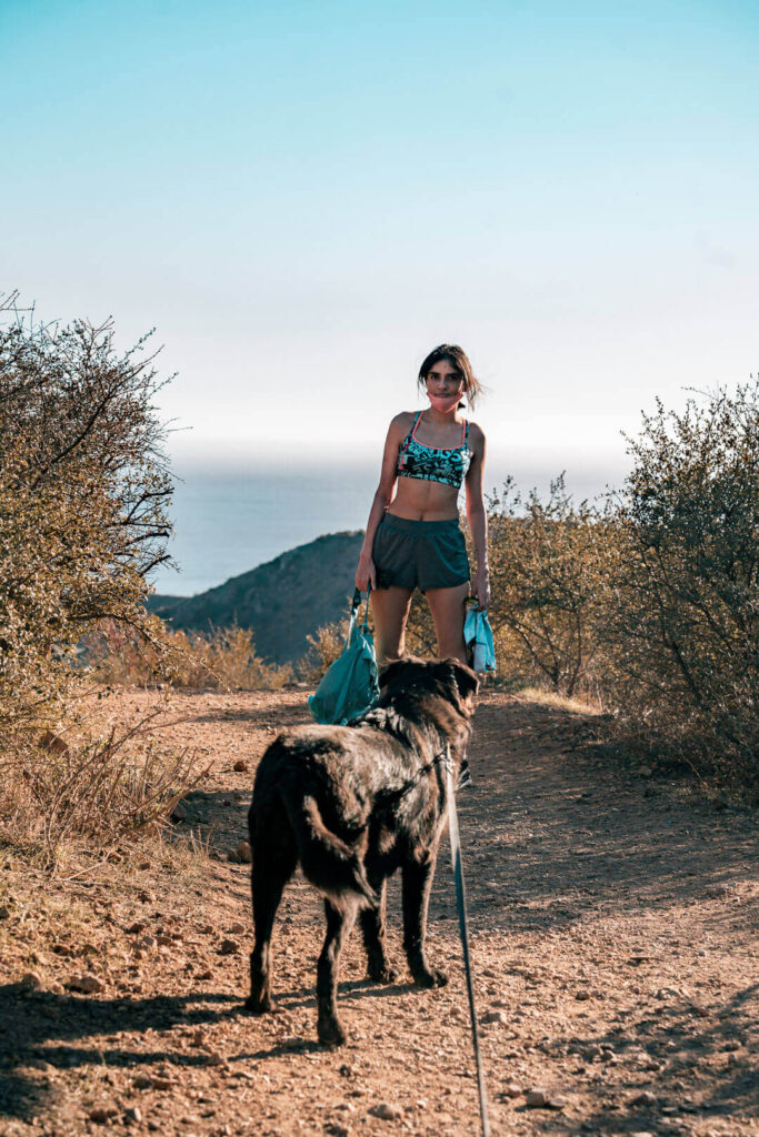
Get a leash for dogs
Some Malibu hiking trails allow dogs and some do not. The trails that allow dogs ask you to keep them on a leash. The fine for breaking this rule goes up to $10k. This is both for the safety of your dog and the safety of others on the trail.
Accessible hikes
All the hiking trails in Malibu are very easily accessible from your car. The trails are all small and there is no need for camping. If you would like to go on longer camping trails then checkout my guide to Joshua Tree National Park which has some of the best campgrounds in southern California.
Leave no trace
Remember that you are in a protected hiking space and show the environment respect by picking up any trash, not throwing wrappers away, not breaking off tree branches or disturbing the environment in any way possible.
Top Malibu Hikes
- Coral Canyon Loop
- Tuna Canyon Trail
- Ocean Overlook Loop
- Escondido Falls Trail
- Solstice Canyon Loop
- Big Sycamore Canyon Loop
- Backbone Trail Loop
- Mesa Peak Trail
- Zuma Canyon Trail
- Lower Malibu Creek Loop
- Malibu Creek State Park
- Charmlee Wilderness Park
Coral Canyon Loop
- Start/finish: Corral Canyon Loop
- Distance: 2.5 miles loop
- Elevation gain: 537-ft
- Difficulty: Moderate
- Dogs: Allowed on leash
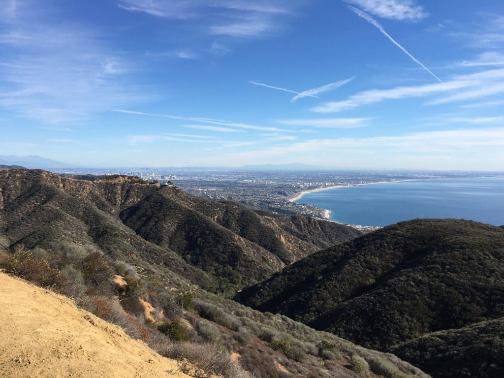
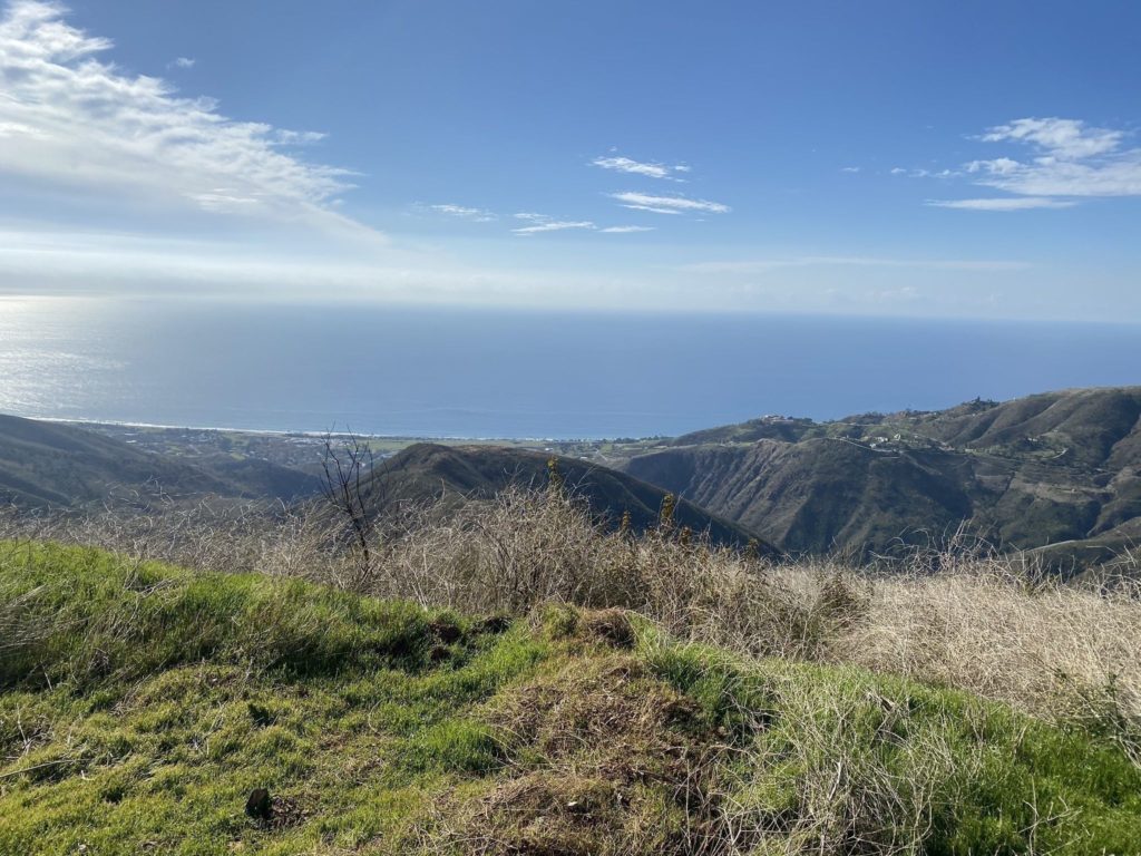
One of the best Malibu hikes is the Coral Canyon in the Santa Monica Mountains. It has a beautiful 2.5 miles loop called the Sara Wan Trail. The coast hugging trail has a decent climb and great views of the ocean. The trailhead is opposite Corral Beach next to the Pacific Coast Highway and costs just $5 for parking. If the parking is full there are many places along the highway to park. Keep going along the coast and you’ll find one of these parking lots within minutes.
Inside the parking lot, it can be a little unclear to spot the way to the trailhead. The main path leads to the Dan Blocker State Beach and not the trail. To get to the trailhead, walk to the north of the parking lot and you will find a small path in the bushes that goes down into the Corral Canyon Creek – this is the trailhead.
You can do the trail starting left or right but the left trail has the oceanic views as you climb higher. The path has some pretty Bay Laurel and sagebrush which smell amazing, especially after rainfall.
At the 1.5miles marker on the trail, you will find another trail branching off of the main one. This takes you to a look point nearby with a full view of the coast from Point Dume to Palos Verde. You can take a break here and take in the views.
The best part about the hike is that the trailhead is next to the Malibu Seafood restaurants where you can satisfy your appetite. They have great fish and chips on the menu. Once you have come back from the hike definitely cool off and try their food.
Tuna Canyon Trail
- Start/finish: Tuna Canyon
- Distance: 5.1 miles loop
- Elevation gain: 900-ft
- Difficulty: Easy
- Dogs: Allowed on leash
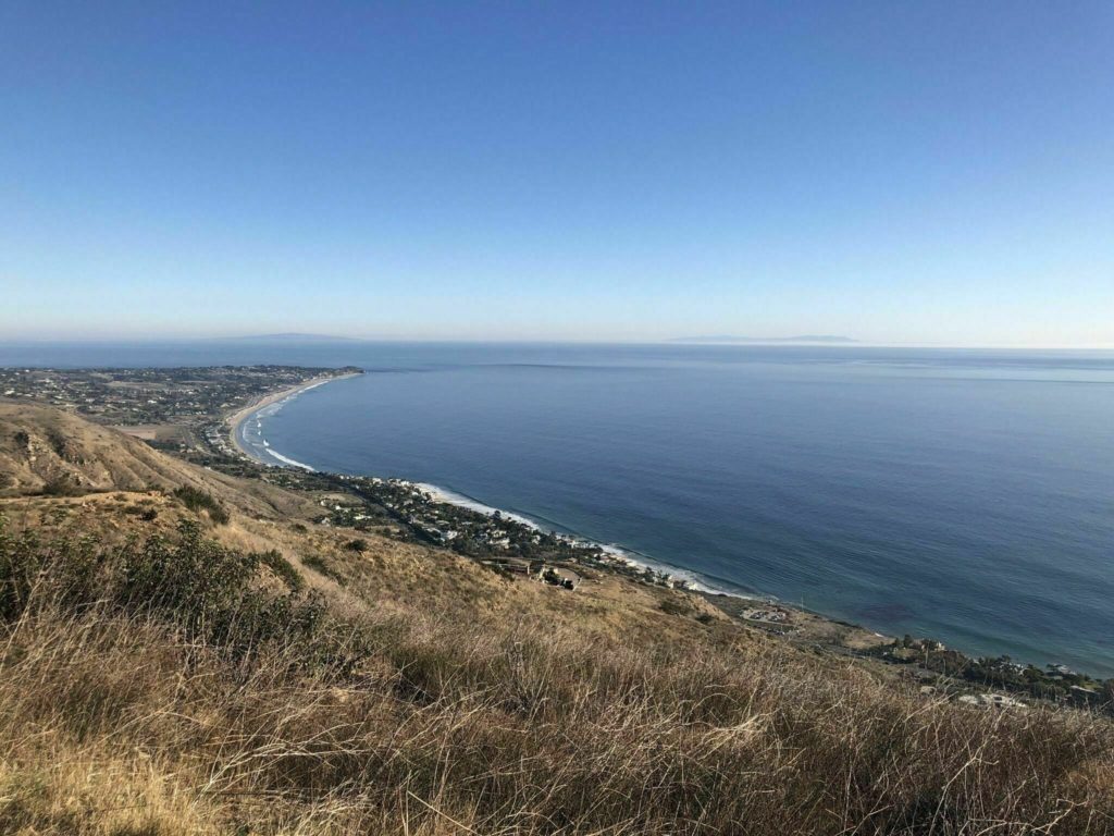
Tuna Canyon Park is a 1250 acre park near Topanga Beach in Malibu. This Malibu hiking trail is relatively easy to do and very popular with families that have younger kids. This is one of the relatively unknown and under visited Malibu hikes with some of the grandest ocean views.
The trail starts at the parking lot at the trailhead and goes upwards into the canyon. At the first intersection along the Big Rock Motorway, the trail branches into two. The left path, Hearst Tank Motorway takes you to the first viewpoint and the highest point in the park. Then you will need to double back to the intersection and take the second path, Big Rock Lateral to the other viewpoint. You then double back again and go back the same way you came.
Tuna Canyon has many other viewpoints and trails that branch off the main trail. You can keep going as long as you prefer. The ocean views are unending and you will find something new at every turn.
Since this Malibu trail still flies under the radar the trailhead is not very well marked even though the fire road is very obvious. The trailhead is between Malibu and Topanga on the outside of a bend in Tuna Canyon Road.
Ocean Overlook Loop
- Start/finish: Charmlee Wilderness Park
- Distance: 2.6 miles loop
- Elevation gain: 462-ft
- Difficulty: Easy
- Dogs: Allowed on leash
Ocean Overlook Loop Trail is a heavily trafficked hiking trail in Malibu. It is extremely popular and fairly easy for all levels of hikers. The Ocean Overloop viewpoint is halfway around the trail and has really pretty views.
This trail is in the middle of all the other trails in the Charmlee Wilderness Park. You can meander off this trail and explore any of the countless other smaller trails in the park.
Escondido Falls Trail
- Start/finish: Winding Way Road
- Distance: 3.7 miles loop
- Elevation gain: 626-ft
- Difficulty: Easy
- Dogs: Allowed on leash
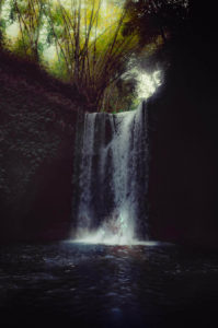
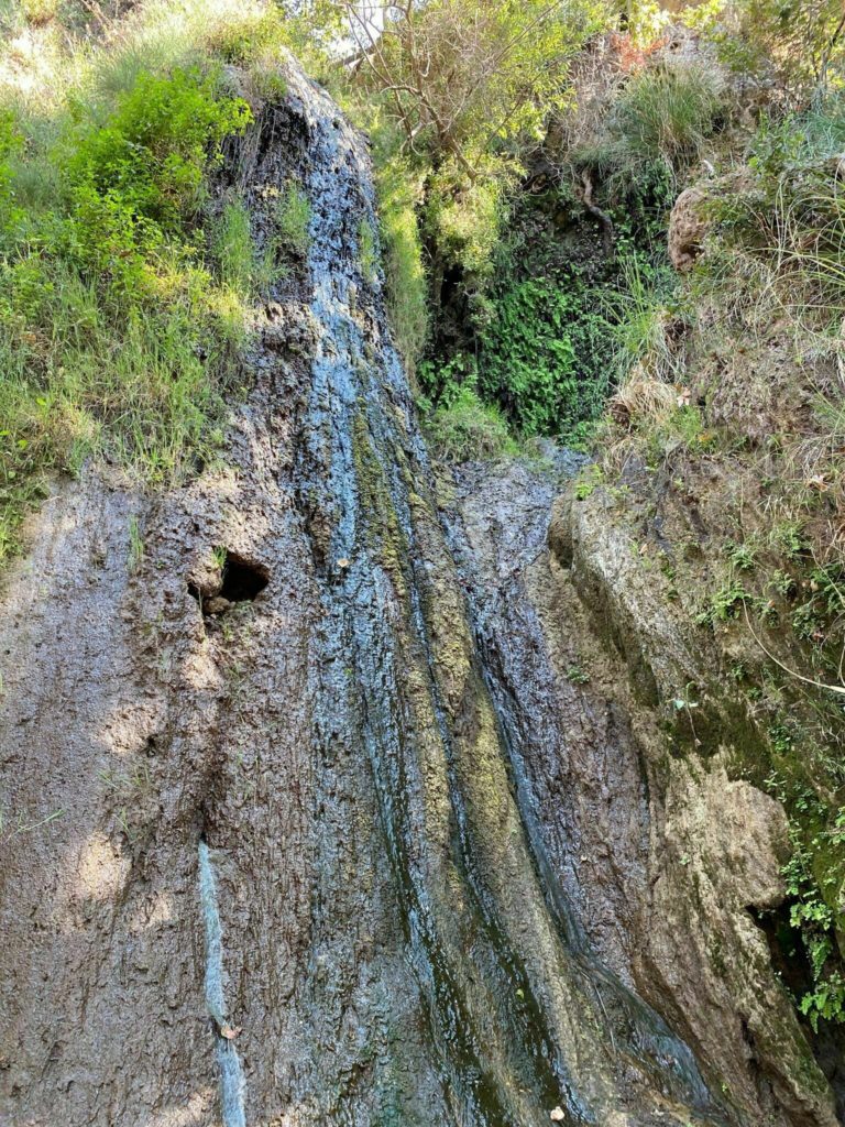
This is a very beautiful trail and one of the few Malibu hikes with a waterfall. The trail crosses over multiple pretty creeks and finally gets to one of the biggest waterfalls in southern California. The trail is gorgeous and very popular during the spring months amongst hikers.
The waterfall has 3 tiers, the lower one passes by the trail and the other two can be climbed by more advanced hikers. Getting to the top of the waterfall is quite an adventure and one of the most rewarding parts of the hike.
The trailhead for this parking lot is on Winding Road off the Pacific Coast Highway. The parking lot is on the corner of Winding Road and PCH. From there you just start walking up the road. The first mile of the trail is a paved road. Keep walking along the road until you see the sign for the Escondido Canyon Trail and Waterfalls. From here the trail is beautiful and has lots of small creeks and pretty foliage.
There are 3 waterfalls on this trail. The first and second one are pretty impressive themselves but the third one is the biggest one with the 3 tiers. I have always loved waterfalls and this is one of my favorite trails in Malibu.
Solstice Canyon Loop
- Start/finish: Solstice Canyon Parking Lot
- Distance: 3.2 miles loop
- Elevation gain: 800-ft
- Difficulty: Moderate
- Dogs: Allowed on leash
The Solstice Canyon trail in Malibu is a very popular day hike. The trails are frequented by locals and you will see lots of people out with their doggies on the trail.
The trail starts at the Solstice Canyon trailhead parking lot. You can go left or right but I recommend starting on the left so you have the ocean views in front of you when coming down.
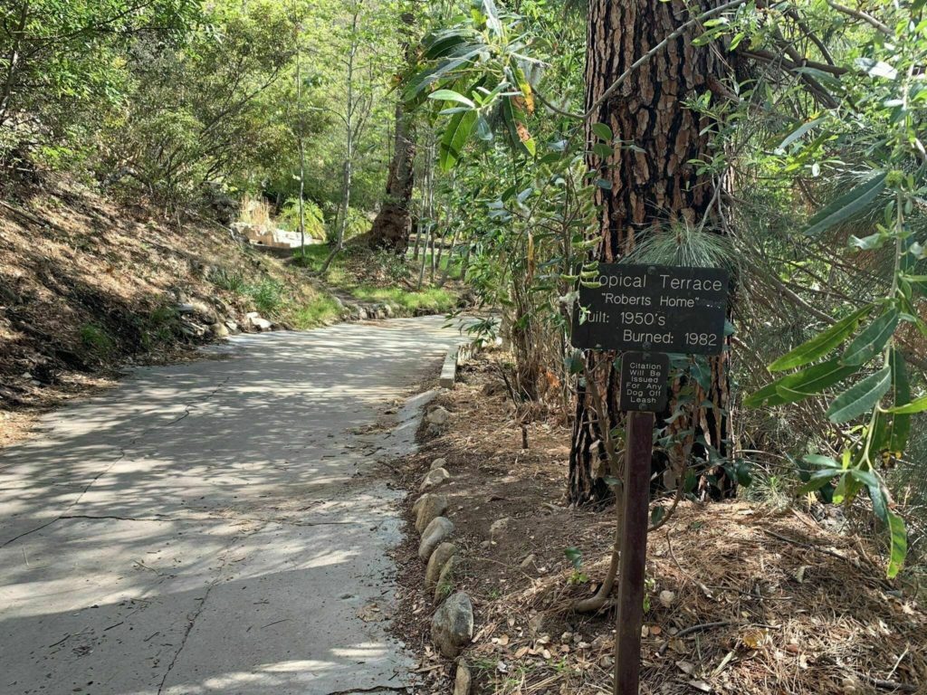
The first part of the trail is the Solstice Canyon Trail where you will pass by Keller House, an abandoned hunting cabin and then onwards to the Tropical Terrace Ruins, a Polynesian style home that was destroyed by fire. This is a cute place to take pictures and rest before continuing on.
Next to the house is a small bamboo staircase that goes to the base of a small constantly flowing waterfall and natural pools. From here you can go back down the same way you came but the pretty views are on the Rising Sun Trail if you continue onwards. The initial part of this trail is challenging but then it levels out and you get really pretty views of the Malibu coastline.
Big Sycamore Canyon Loop
- Start/finish: Sycamore Canyon Trailhead
- Distance: 10.2 miles loop
- Elevation gain: 1210-ft
- Difficulty: Moderate
- Dogs: Allowed on leash
This is a gorgeous Malibu trail made up of three smaller Malibu hikes. The Big Sycamore Canyon Loop is made up of the Sycamore Canyon Trail, Backbone Trail, Overlook Trail and the Scenic Trail. The trailhead for the loop is at the Big Sycamore Canyon Campground. Walk through the parking lot towards the north where there is a yellow gate at the edge of the fire road. This is the trailhead. You can park at the parking lot for $12 per day.
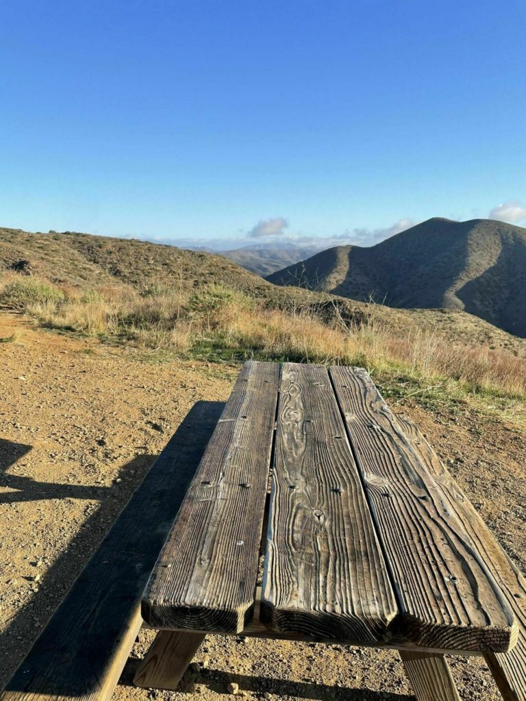
During the loop, one mile off the juncture off the Serrano Canyon Trail there is a pretty picnicking spot complete with a picnic table in the shade. On the Overloop Trails there are great views of the Big Sycamore Canyon and Boney Peak.
Once you reach the highest point of the hike the trail gets easier and it’s flat and downhill from there. During the fall season there are a lot of monarch butterflies in this area.
The trail is also very popular for mountain biking so you have to share the trail with them. Be careful of them as you walk the trail.
Backbone Trail Loop
- Start/finish: Calabasas Peak Trailhead
- Distance: 7.5 miles loop
- Elevation gain: 2020-ft
- Difficulty: Moderate
- Dogs: Allowed on leash
The actual Backbone Trail is some 67 miles long in the beautiful Santa Monica Mountains. There is a particular loop – Backbone Trail Loop in Malibu that hikers like to do as a day hike.
This 7.7 mile starts near Calabasas, California and known for the nature and foliage you can see on this trail. The trailhead for this Malibu hike is the Calabasas Peak Trailhead on Stunt Road.
The first part of the trip is steep but then it gradually goes downhill and becomes easier. You should start the trail on the left and then end on the right which is easier to do. The views of the surrounding areas from here are absolutely gorgeous and you can see the pretty Santa Monica Mountains the whole way.
Mesa Peak Trail
- Start/finish: Backbone Trailhead
- Distance: 4.8 miles loop
- Elevation gain: 1430-ft
- Difficulty: Moderate
- Dogs: Allowed on leash
This gorgeous Malibu hiking trail near Calabasas has some amazing views of the coastline and the Santa Monica Mountains. The trailhead is actually higher than the actual peak but it is quite an interesting hike. The trailhead is the same as for the Backbone Trailhead at the Malibu Creek State Park but you will be hiking in the opposite direction. Head east from the parking lot where you will find the Mesa Peak Motorway.
Around 1.7 miles from the start of the trail you get to the highest point in the trail. After you reach the intersection in the road, continue left on Puerco Motorway which steps down slightly to get to Mesa Peak.
The incredible views of the coastline and surrounding mountains are breathtaking.
Zuma Canyon Trail
- Start/finish: Zuma Ridge Trailhead
- Distance: 3.7 miles loop
- Elevation gain: 650-ft
- Difficulty: Moderate
- Dogs: Allowed on leash
The Zuma Canyon trail in Malibu is one of the most adventurous trails if you are willing to go out of your comfort zone. The trail is a sandy track follows a small creek in the Santa Monica Mountains and doesn’t have much elevation at the start.
After 1.4 miles the trails ends at the canyon narrows. If you are more adventurous then keep going. The Zuma Canyon Narrows do not have a hiking path and you have to make your own way. The hike ends at the crossing of the Edison Service Road.
This trail is for those that like to push themselves and really explore the outback.
Other trails that branch out from the trailhead for Zuma Canyon are Scenic Trail which combined with Zuma Canyon Trail makes a loop, Zuma Loop Trail and Ocean View Trail and Canyon View Trail Loop. These 3 are also incredible hikes in Malibu.
Lower Malibu Creek Loop
- Start/finish: Malibu Canyon Road
- Distance: 8 miles loop
- Elevation gain: 224-ft
- Difficulty: Moderate
- Dogs: Allowed on leash
The Lower Malibu Creek Loop hiking trail in Malibu is a beautiful 8 mile loop for adventurous hikers that is considered moderately hard. There are multiple creekside pools where you can take a dip, and rock formations nearby that are a good spotting for rock climbing.
There have been lots of TV shoots around this area and you can still see remnants of the old M.A.S.H set 2.5 miles into the trail.
One thing you should not miss on the trail is the Rock Pool. Once you reach the 6.5 mile marker at the concrete bridge atop the creek you will find an unmarked trail towards the west. This trail leads to Rock Pool, the most popular spot to hang out on the Lower Malibu Creek Loop. To get back follow the unmarked trail back to the mail trail.
Lower Malibu Creek Loop is one of the most fun hikes in Malibu during the summer because of all the cool pools and views you can enjoy simultaneously.
Malibu Creek State Park
Malibu Creek State Park is the crown jewel of the Santa Monica Mountains. The park has more than 8000 acres of pretty trails, picnic areas, and gorgeous views of the surrounding mountains. There are multiple trails that you can do in the park. Some of the best trails in Malibu are inside the park including Mesa Peak, Zuma Canyon Trail and Lower Malibu Creek Loop.
The park also has a lake where you can go kayaking! At the Rock Pool there is rock climbing and horseback riding at Reagan Ranch. There is so much to do around here you can spend the entire weekend exploring the park.
Charmlee Wilderness Park
Charmlee Wilderness Park is a gorgeous 532 acre park with around 8 miles of trails in Malibu. The Park has hiking trails, picnic areas and a nature center. Exploring this park was an incredibly fun way to spend the day. It has some of the best Malibu hikes like the ones listed below. You can park at the main parking lot for $4 for one day use. Some of the best hiking trails in Malibu can be found at Charmlee – Ocean Overlook Trail, Escondido Falls and the Solstice Canyon Loop Trail.
Other California Posts
Top 10 National Park Road Trips from LA
Ultimate 24 Day 12 Stop California PCH Road Trip Itinerary
Best Glamping Airbnbs in Joshua Tree: Airstreams, Yurts and Cabins