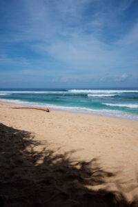
Bali is one of the most beautiful islands on this planet. It has so much natural beauty on the island it’s hard to see everything in one trip. The island has waterfalls, lots of gorgeous beaches with the sea stretching out for miles. But unless you’re a geography lover you probably don’t know where the island is. So where is Bali located exactly and what country is Bali located in? Or is Bali a country itself?
No worries, this blog answers all the questions related to the location of Bali on the world map. You will also find other information about the geography and terrain of Bali. A handy map to figure out the terrain and places of the tourist spots in Bali is also included.
I had a lot of family members ask if Bali was a country when I was leaving to go to Bali and how it was a Hindu island if it was part of Indonesia which is a predominantly Muslim country so it’s safe to say people everywhere are a little confused about where Bali is located.
Where is Bali located on the world map?
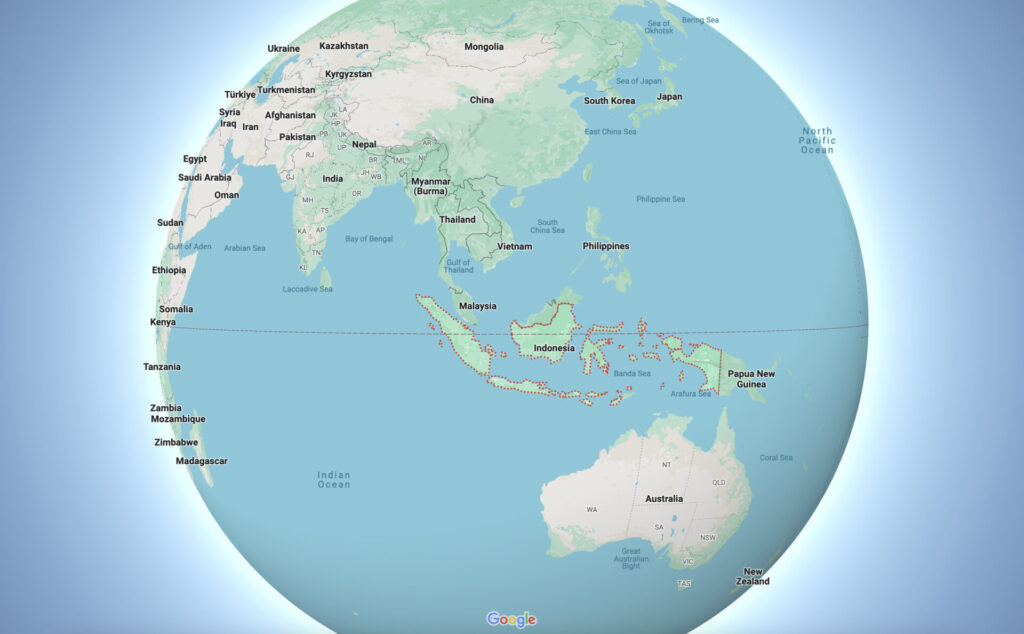
Bali is part of Indonesia, which is a country in the Indian Ocean. Indonesia is an archipelago of 17,000 islands close to Australia. Indonesia is the country right above Australia on the world map. It is surrounded by the Philippines, Malaysia and Papa New Guinea.
Is Bali a country?
This is a common misconception amongst people but Bali is not a sovereign country. It is part of Indonesia. It is the only Hindu island in Indonesia and the culture is very different which is why people tend to think that Bali is a country itself.
Where is Bali located in the Indian Ocean?
Bali is located in the Indian ocean right above Australia. It is a good surf destination because it receives currents from the Indian ocean . The south part of Bali is especially vulnerable to ocean currents because it faces the open ocean. The north and eastern parts are protected by other islands surrounding Bali.
What country is Bali in? Is Bali in Indonesia?
Yes, Bali is part of Indonesia. It is one of the 17,000 islands in Indonesia. A lot of people think that Bali is its own country but that is not true. After you land in Bali you get a visa to the country of Indonesia.
Where is Bali located in Indonesia?
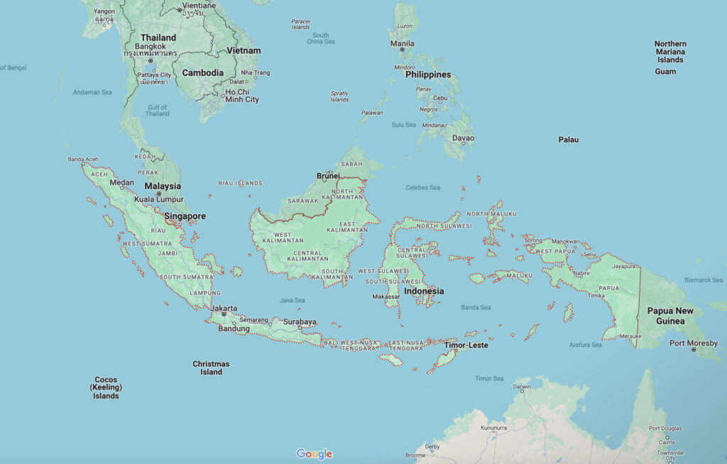
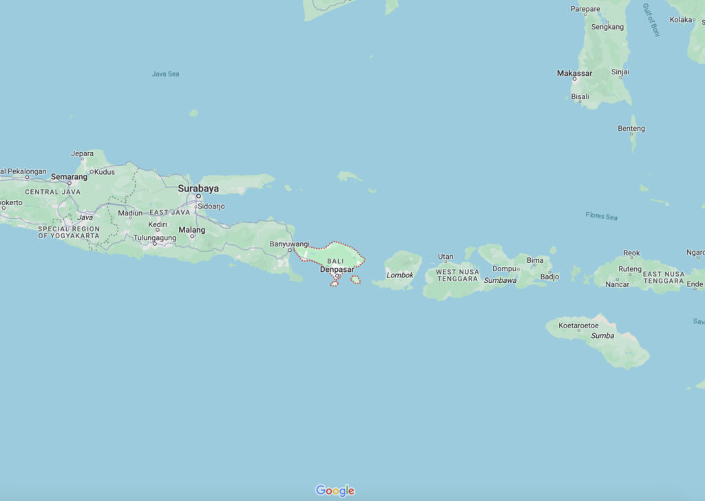
Finding the island of Bali in Indonesia is fairly easy. Bali has a very unique shape that can be easily spotted on the map. Indonesia curves downwards and towards to right before becoming a straight horizontal line that faces the north coast of Australia. Bali is in the middle of the straight face of Indonesia. You can see the island in the map below.
To the right of Bali is the island of Lombok. This is a well touristed island and lots of people from Bali take ferries to Lombok to spend a couple days there. Gili Air, Gili Meno and Gili Trawangan are part of Lombok. Lombok is around 123 km away from Bali.
To the left of Bali is the island of Java. At one point in the past, Java and Bali used to be connected by land. Java is a huge island and one of the biggest islands in Indonesia. You can do day trips to Java and Lombok both from Bali.
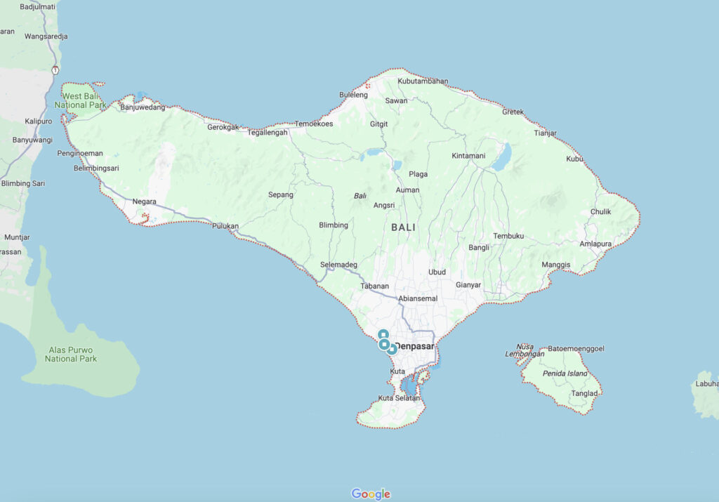
Bali Regions
Bali has 8 different agencies and the city of Denpasar which is its own separate region but not categorized as a regency. The 9 regencies of Bali are listed below.
Badung
Badung is where the city of Kuta and the Ngurah Rai Airport. It is the first place you will see when you leave the airport after flying into Bali. Badung is also the regency which has the towns of Canggu and Uluwatu. Most of the tourists only visit this regency and these towns in Bali.
Gianyar
If you go to the right of Badung you will come to Gianyar which is where Ubud is. This regency has a lot of picturesque rice fields. The UNESCO site at Tegalalang Rice Fields is also in Gianyar.
Tabanan
If you keep going north of Badung you will get to Tabanan. This regency has the Jatiluwih rice fields and the Ulun Danu Bratan Temple.
Klungkung
This regency in Bali has some area on mainland Bali but it also includes the islands of Nusa Penida, Nusa Ceningan, and Nusa Lembongan. Nusa Penida is known for its sighting of Manta Rays. A lot of tourists go to the island to snorkel and dive with Manta Rays and Mola Mola sunfish.
Bangli
This area is known for Mount Batur. Mount Batur is an active volcano where people go for hiking. Most tours take you to the summit so that you can watch the sunrise when you get to the top. You can also go to the village of Kintamani near the volcano.
Buleleng
This regency covers the entire north coast of Bali. The north coast of Bali has a lot of waterfalls like the Singaraja waterfall and Munduk waterfall. It’s also known for its black sand beach of Lovina where you can see dolphins during sunrise.
Karangasem
The east coast of Bali which is known for its abundant diving opportunities near the town of Amed and Tulamben are inside Karangasem. Tulamben is known for being the site of the USAT Liberty Shipwreck where lots of divers go to see various sea life.
Jembrana
This is the north west part of Bali that sticks out to the left. Not many people visit this place because there are no developed towns here.
Denpasar
This is the part of Bali that is most densely populated. The ferries to Nusa Penida depart from the dock of Sanur that is close to here. Most tourists don’t visit this place since it mostly has residential houses of the locals, government offices and other businesses and their offices.
Checkout Other Bali Posts
Seganing Waterfall in Nusa Penida